Malaga lightens 'plaza-bridges' over Guadalmedina riverbed and designs green corridor in central section
There are five months to draw up the preliminary project, which must respect all the hydraulic calculations that have been made to guarantee safety in the event of flooding as approved by the Cuenca Mediterránea

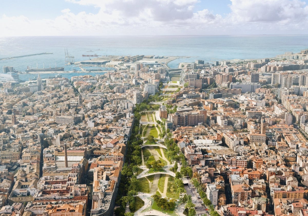
The design of the urban integration of the Guadalmedina riverbed in Malaga was revealed on Thursday, 14 August. In short, the large central 'plaza-bridge' (one of the identical structures to create a large square connecting the Centro and Trinidad districts), which in practice was almost an enclosed structure, has been removed. Instead of three of these structures there will be five, lighter, X-shaped structures. The aim is to guarantee permeability between the two banks of the river by lowering the side walls, which act as a barrier. For this to happen, it has been necessary to fine-tune the hydraulic modelling in order to know the behaviour of the river in the worst flood scenarios. Another facet of the preliminary project is the creation of a green corridor along the entire central section with medium-sized trees.
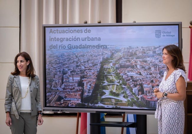
The councillors for environmental sustainability and town planning - Penélope Gómez and Carmen Casero - presented the design, chosen through a competition process. Consultancy firm Esteyco now has five months to develop the idea presented, which may be subject to minor modifications. What cannot be touched are the slopes of the river, the riverbed and the hydraulic calculations, which have already been approved by the Cuenca Mediterránea Andaluza. The budget for the preliminary project exceeds 300,000 euros.
-u23630882763apo-650x455%40diario%20sur.jpg)
It is important to note that the old belief that the river drains 600 cubic metres per second was rendered obsolete a few years ago by the report prepared by Cedex - a central government agency. A new modelling was commissioned and 66 simulations were carried out, resulting in a complete survey of the terrain. Now, all the contributions of the tributary streams to the river have been measured in an adverse scenario with complete silting and embankment. In other words, caution has been taken to the extreme. On top of that, the rules for the operation of the El Limonero dam were changed years ago. In short, the reservoir is now left emptier for greater protection.
Digital models present a clearer picture given the conditions caused by 'danas' (heavy cold drops) and storms, which are likely to increase, as they did these past winter and spring. The project phase is likely to start during the first quarter of next year. At the same time, the city council wants to make progress on all the necessary sectoral reports and, in due course, an environmental impact statement will have to be processed.
In detail
The slope of the riverbed is maintained at 0.47 and two rapids are designed in the same style as the existing ones but at the Escuela de Idiomas and El Perchel bridge.
At the same time, the existing underground traffic routing is expanded and what already exists is lowered to generate one and a half metres of earth substrate that allows for a green corridor with medium-sized trees in the central section of the river..
Public spaces
The idea is to always guarantee a one-metre water buffer with respect to the bridge decks to ensure that the river does not overflow.
The proposal envisages the creation of public spaces and recreational areas in the form of 'plaza-bridges' connecting both banks, while at the same time establishing a large green corridor along the riverbed and the underground routing of a section of the lateral roads (the avenues of Fátima and La Rosaleda).
According to Esteyco's proposal, the bridges will be X-shaped, connecting both banks of the river through diagonal paths, creating living spaces and play areas.
Dimensions
The solution proposed by the contractor, pending further details to be included in the preliminary project, proposes the creation of three 'plaza-bridges' of up to 3,000 square metres each between the Armiñán and Aurora bridges instead of a single large one, in order to enhance the permeability between the urban fabric and the riverbed and not detract from the river's prominence. The other two, of a similar surface area, will be located at the height of Santo Domingo and the current Trinidad bridge. In addition, a green park is planned between the Armiñán bridge and the El Perchel pedestrian walkway.
Margins
All these actions will be complemented with interventions in the surrounding streets - Avenida de Fátima and Pasillo de Santo Domingo on the right bank; and Avenida de la Rosaleda and Pasillo de Santa Isabel on the left bank.
Five phases of work
At the moment, the work is planned in five phases to allow the constructive feasibility and compatibility of the 'plaza-bridges' with the lowering of the riverbed and the future burying of surface roads, with an initial estimated investment of 86.3 million euros (IVA included).
As for other schedules, the Plaza de Santo Domingo and Trinidad bridges can be done without lowering the riverbed, so they can be scheduled earlier depending on budget availability.
Regarding the river’s capacity, four sections are defined to generate the aforementioned model. The first, in the area around the dam, is 310 cubic metres per second. The second, with the addition of the Virreina stream, is 360. The third, at the confluence with the Palma stream, 400. The fourth and last, with the contributions of the Los Ángeles stream up to the mouth, is set at 460 cubic metres per second. With the calculations made, the safety threshold is theoretically increased by 27%.

Comentar es una ventaja exclusiva para registrados
¿Ya eres registrado?
Inicia sesiónNecesitas ser suscriptor para poder responder.
Necesitas ser suscriptor para poder votar.